
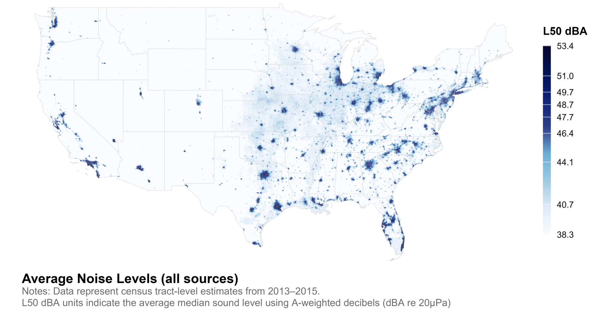
The CDR National Park Service (NPS) Geospatial Sound Monitoring Files include three measurements of all existing sound levels, natural sound levels without human sounds, and impact sound levels calculated as the difference between existing and natural sound levels. CDR provides 3-year estimates (2013-2015) of these measurements at the census tract-level for the contiguous U.S., Alaska, and Hawaii.
Data Summary
Dataset Name: National Park Service (NPS) Geospatial Sound Modeling Files
Data Source: National Park Service (NPS)
Years: 2013-2015, 3-year estimates
Geographies: Census Tract
Suggested Citation:
Jennifer Ailshire, Kate Vavra-Musser, Calley E. Fisk. 2024. Contextual Data Resource (CDR): National Park Service Geospatial Sound Modeling Files by Census Tract, 2013/15. Los Angeles, CA: USC/UCLA Center on Biodemography and Population Health.
Data Sources
National Park Service (NPS). Geospatial Sound Modeling, https://irma.nps.gov/DataStore/Reference/Profile/2217356